Centretown
A compact, apartment-heavy area a short walk from Parliament Hill.
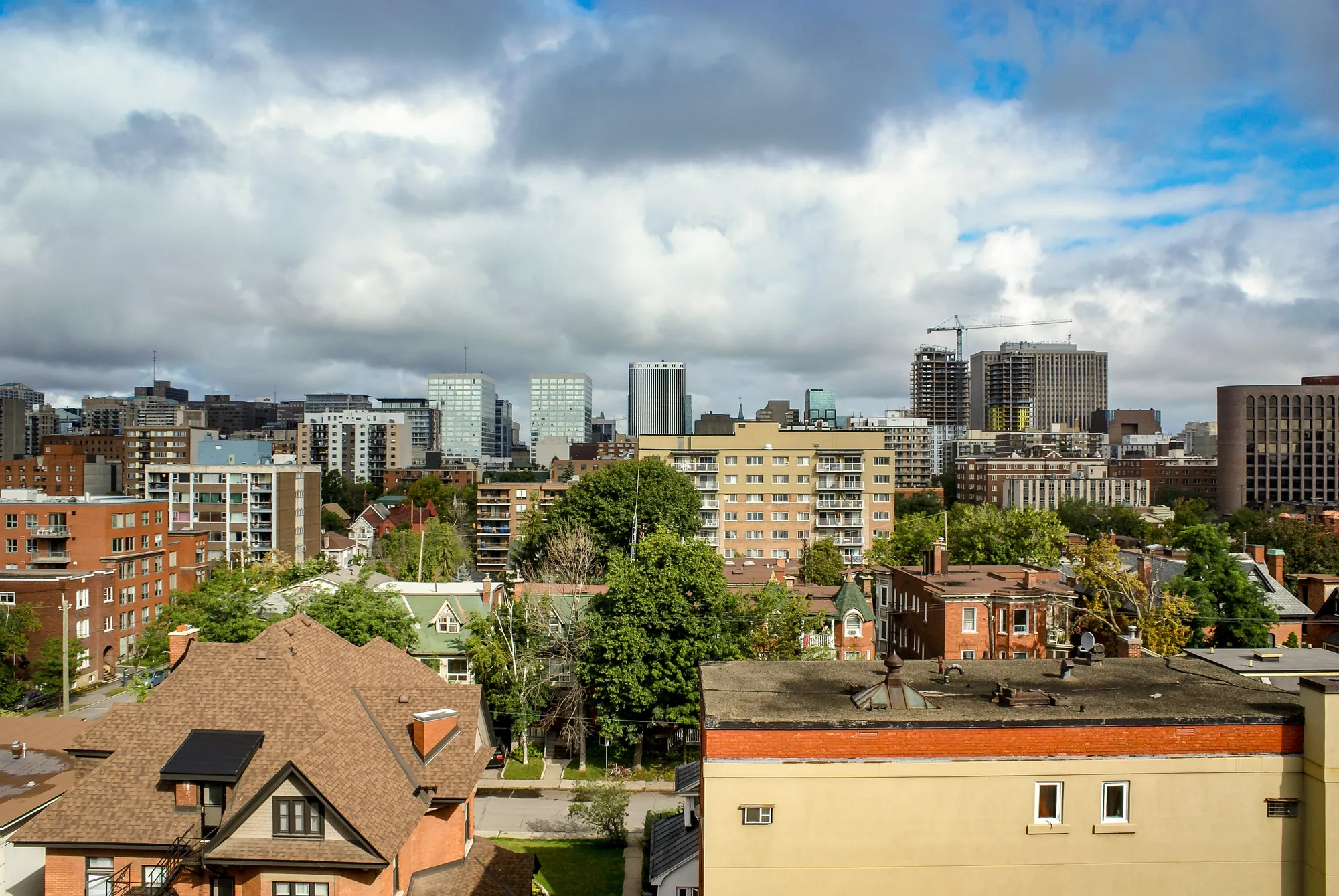
In the 2021 census (via the Ottawa Neighbourhood Study), Centretown had 31,890 residents and 22,810 private dwellings, with a median age of 34.8 and an average household size of 1.5. Population: 31,890 (2021).
Updated · Facts on this page link to their sources
About Centretown
In the 2021 census (via the Ottawa Neighbourhood Study), Centretown had 31,890 residents and 22,810 private dwellings, with a median age of 34.8 and an average household size of 1.5. Most dwellings are apartments: 67.1% are in buildings of five or more storeys. Renters make up 75.3% of households. The ONS average Walk Score is 69 and the Bike Score is 95. Parliament Hill is about 0.8 km away in a straight line.
Boundaries
Ottawa Neighbourhood Study area Centretown; the City's own definition runs from Gloucester and Lisgar streets to the Queensway, and from Bronson Avenue to the Rideau Canal. ons-sqo.ca ons-sqo.ca
Homes
In the 2021 census (via the Ottawa Neighbourhood Study), 67.1% of Centretown dwellings were apartments in buildings of five or more storeys and 23.4% were apartments in buildings under five storeys. Single-detached houses were 3.0%, row houses 3.2%, semi-detached houses 1.6% and flats in a duplex 1.5%. Renters made up 75.3% of households and owners 24.7%; the median owner-estimated value of owned dwellings was $500,000 (2021 census, not a sale price). ons-sqo.ca
- Parliament Hill is about 0.8 km away (straight-line).
- Parliament and Lyon O-Train stations (Line 1) are about 0.5 and 0.6 km away (straight-line).
- 37.9% of workers commuted on foot in 2021; 57.7% worked from home.
- Tree canopy coverage was 15.4% in 2024.
- 93.6% of residents are within a 15-minute walk of a community health centre (ONS current data).
- Ottawa Public Library Main Library is about 0.4 km away (straight-line).
Community
How Centretown came to be
- 1872
The area was represented in Parliament by two members from 1872 to 1935. en.wikipedia.org
- 2009
The City of Ottawa launched a Mid-Centretown Community Design Plan study, which has since come to cover all of Centretown. en.wikipedia.org
Traditionally, Centretown meant all of Ottawa west of the Rideau Canal, while Lower Town was everything to the east. en.wikipedia.org
A construction boom that began in the late nineties significantly increased the number of condominiums and other residential and commercial high-rise buildings north of Cooper Street. en.wikipedia.org
Local names worth knowing
- Sir Wilfrid Laurier
Listed among the Members of Parliament who represented the area, as a Liberal from 1908 to 1910. en.wikipedia.org
- Ed Broadbent
Listed among the Members of Parliament for Ottawa Centre, as an NDP member from 2004 to 2005. en.wikipedia.org
- Paul Dewar
Listed among the Members of Parliament for Ottawa Centre, as an NDP member from 2006 to 2015. en.wikipedia.org
- Catherine McKenna
Listed among the Members of Parliament for Ottawa Centre, as a Liberal from 2015 to 2021. en.wikipedia.org
Around Centretown
Walking rings at 5, 10 and 15 minutes from the neighbourhood centre.
Schools
10 nearbyCentennial Public School
OCDSB376 rue Gloucester Stmaps.ottawa.ca ocdsb.ca
580 m7 min walkElgin Street Public School
OCDSB310 rue Elgin Stmaps.ottawa.ca ocdsb.ca
620 m8 min walkUrban Aboriginal Alternate Program
OCDSB440 rue Albert Stmaps.ottawa.ca ocdsb.ca
680 m8 min walkGlashan Public School
OCDSB28 av. Arlington Avemaps.ottawa.ca ocdsb.ca
870 m11 min walkLisgar Collegiate Institute
OCDSB29 rue Lisgar Stmaps.ottawa.ca ocdsb.ca
880 m11 min walkRichard Pfaff Secondary Alternate Program
OCDSB160 rue Percy Stmaps.ottawa.ca ocdsb.ca
890 m11 min walkCambridge Street Community Public School
OCDSB250 rue Cambridge St Nmaps.ottawa.ca ocdsb.ca
1.1 km14 min walkSaint-Jean-Baptiste Catholic Secondary Campus
CECCE96 Empress Avenuemaps.ottawa.ca ecolecatholique.ca
1.1 km14 min walkSt. Anthony School
OCSB391 rue Booth Stmaps.ottawa.ca ocsb.ca
1.4 km18 min walkCatholic Elementary School in The Heart of Ottawa
CECCE88 rue Main Stmaps.ottawa.ca ecolecatholique.ca
1.5 km18 min walk
Straight-line distances from the Centretown centre. Living near a school does not guarantee a place: confirm the designated school for an address with each board. All schools and board locators.
Parks & places
10 nearbyTemporary Parkette (2017-2022)
Passive Recreation park
234 O'Connor Streetmaps.ottawa.ca
210 m3 min walkOttawa Public Library Main Library
Public Library
120 Metcalfe Stmaps.ottawa.ca biblioottawalibrary.ca
420 m5 min walkLisgar Parkette
Passive Recreation park
342 Nepean Street, Ottawamaps.ottawa.ca
460 m6 min walkDundonald Park
Active Recreation park
516 Somerset Street West, Ottawamaps.ottawa.ca
500 m6 min walkSplash pad, Dundonald Park
Splash pad (summer only)
516 Somerset Street West, Ottawamaps.ottawa.ca
540 m7 min walkRolla Law Crain Park
Active Recreation park
375 Byron Avenue maps.ottawa.ca
550 m7 min walkJack Purcell Community Centre
Recreation Complex
320 Jack Purcell Lnmaps.ottawa.ca ottawa.ca
640 m8 min walkJack Purcell Park
Active Recreation park
320 Jack Purcell Lane, Ottawamaps.ottawa.ca
670 m8 min walkOutdoor rink, Jack Purcell Park
Outdoor rink (winter, weather permitting)
320 Jack Purcell Lanemaps.ottawa.ca ottawa.ca
670 m8 min walkMinto Park
Passive Recreation park
315 Elgin Street, Ottawamaps.ottawa.ca
740 m9 min walk
Shops & dining
10 nearbyYour Independent Grocer
Supermarket
296 Bank Streetopenstreetmap.org
210 m3 min walkShoppers Drug Mart
Pharmacy
174 Bank Streetopenstreetmap.org
210 m3 min walkSomerset Village BIA
Business improvement area (City of Ottawa BIA layer)
220 m3 min walkLoblaw Pharmacy
Pharmacy
296 Bank Streetopenstreetmap.org
220 m3 min walkCentretown BIA
Business improvement area (City of Ottawa BIA layer)
300 m4 min walkCentretown Pharmacy
Pharmacy
326 Bank Streetopenstreetmap.org
320 m4 min walkCapital Home Medical Equipment
Pharmacy
267 O'Connor Streetopenstreetmap.org
360 m5 min walkDowntown BIA
Business improvement area (City of Ottawa BIA layer)
390 m5 min walkFarm Boy
Supermarket
193 Metcalfe Streetopenstreetmap.org
400 m5 min walkRexall
Pharmacy
407 Laurier Avenue Westopenstreetmap.org
440 m6 min walk
Getting around
TransitBank South station
Transitway / transit station (City of Ottawa transit stations layer)
openmaps.ottawa.ca
360 m5 min walkBank North station
Transitway / transit station (City of Ottawa transit stations layer)
openmaps.ottawa.ca
420 m5 min walkKent South station
Transitway / transit station (City of Ottawa transit stations layer)
openmaps.ottawa.ca
440 m6 min walkKent North station
Transitway / transit station (City of Ottawa transit stations layer)
openmaps.ottawa.ca
500 m6 min walkO-Train
Parliament station is about 0.5 km away in a straight line (open; Line 1).
O-Train
Lyon station is about 0.6 km away in a straight line (open; Line 1).
Transitway / bus
Bank South station is about 0.4 km away in a straight line (open).
Downtown
Parliament Hill is about 0.8 km away in a straight line.
For sale in Centretown
No Centretown homes on centretown.homes right now
Selling here? Get a website for your home, or browse every home for sale in the area.
Neighbouring areas
Quick answers
Short answers first; each links to the full answer and its sources.
Is Centretown a good place to live?
Whether Centretown suits you depends on what you want from a home, and the facts describe a compact, apartment-heavy area close to downtown. In the 2021 census (via the Ottawa Neighbourhood Study), Centretown had 31,890 residents, 75.3% renter households and an average household size of 1.5. Its ONS average Walk Score is 69 and its Bike Score is 95.
As of 2026-10 · ons-sqo.ca en.wikipedia.org
Where is Centretown in Ottawa?
Centretown is a neighbourhood in Somerset Ward, in central Ottawa, Ontario. The City defines it as the area bounded by Gloucester Street and Lisgar Street on the north, the Rideau Canal on the east, the Queensway on the south and Bronson Avenue on the west.
As of 2026-10 · en.wikipedia.org
How far is Centretown from downtown Ottawa?
Centretown is about 0.8 km from Parliament Hill in a straight line (as the crow flies), which this guide uses as its downtown reference point. West Centretown is about 2.0 km from Parliament Hill by the same measure.
As of 2026-10 · en.wikipedia.org en.wikipedia.org
What schools serve Centretown?
Centretown is near OCDSB, OCSB, CECCE and CÉPEO schools. The nearest elementary schools by straight-line distance are Centennial Public School and Elgin Street Public School (both OCDSB, about 0.6 km), then Cambridge Street Community Public School (OCDSB, about 1.1 km). Which school serves a specific address depends on its catchment, so families must confirm with each board's school locator.
As of 2026-10 · maps.ottawa.ca maps.ottawa.ca
Are there French-language schools in Centretown?
Yes, French-language schools are listed near Centretown. Saint-Jean-Baptiste Catholic Secondary Campus (CECCE) is about 1.1 km away and Catholic Elementary School in The Heart of Ottawa (CECCE) is about 1.5 km away, both in a straight line. Families must confirm eligibility and catchments with each board's school locator.
As of 2026-10 · maps.ottawa.ca maps.ottawa.ca
Which high schools are near Centretown?
The nearest secondary schools to Centretown, in a straight line, are Lisgar Collegiate Institute (OCDSB, about 0.9 km), Saint-Jean-Baptiste Catholic Secondary Campus (CECCE, French-language, about 1.1 km) and Immaculata High School (OCSB, about 1.5 km). Families must confirm which school serves an address with each board's school locator.
As of 2026-10 · maps.ottawa.ca maps.ottawa.ca